FlightPath3D has expanded its 3D map products with the addition of Flying Over Places. The new feature can be retrofitted into all existing 3D map installations.
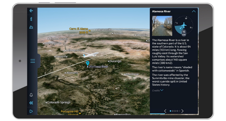
FlightPath3D President Duncan Jackson stated: “Flying Over Places significantly expands our map feature set with the integration of over 50,000 points of interest (POIs) that auto-play as the flight progresses, providing historical information about landmarks, attractions, and places as they’re flown over en route.”
Jackson adds: “We want every airline to be able to inform their customer what they can see out the window, with each point displaying its distance and direction.”
FlightPath3D CEO Boris Veksler said: “We design and deploy apps that are available as an Android, iOS or Linux app, can be streamed as a web service or API, and as widgets that can be embedded in other applications.”