FlightPath3D has announced its 3D Map is now capable of supporting Vertical Take-Off and Landing (VTOL) applications. The product was launched on a fleet of Sikorsky S92 helicopters with an undisclosed private customer.
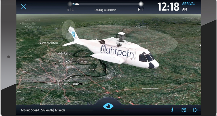
The moving map features a direct point to point flight travel set in a game-like 3D interactive experience with high-resolution satellite imagery, immersive virtual reality cockpit head-up-display, and VTOL 360 view.
“Building our VTOL 3D Map application to support direct point to point travel required additional intelligence to generate a dynamic route in 3D, enhanced cockpit view and upgraded satellite resolution imagery to zoom down to 60 cm”, said FlightPath3D CEO Boris Veksler.
The VTOL 3D Map is customised for the operator with their own personal livery. It provides valuable flight information like time to destination, expected arrival time, altitude, groundspeed, and bearing and mission-specific data. Any time the pilot changes the route, passengers are automatically updated, and the route reflects those changes.